Thursday, September 23, 2010
Los Uros Islands of Lake Titicaca


I got the chance to visit a couple of distinct cultures on Lake Titicaca. One of those, Los Uros, is an Aymara-speaking community of about 40 islands near the city of Puno. They use floating islands that are made from the roots of the totora plant that are staked to the floor of the lake. Then, the roots are covered with many layers of totora plant. This plant is used for their boats, homes, islands, and fuel.
Peruvian Mountains


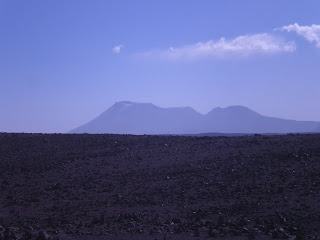
I never climbed any of the mountians surrounding Arequipa because the altitude difference between the city level and the tops of the mountains and volcanos is too much but I did find some good views. The piles of rocks near the road are blessings to the mountain gods that the local people have offered.
Agricultural Terraces


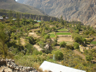
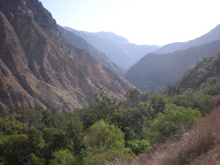
Here are a few more pictures of the agricultural terraces I described in an earlier blog. The first two pictures are of a location on the way to the canyon. Be sure to click on the second picture to get a larger view and a better idea of how widespread this agricultural method is used. The third picture, and nominee for the best picture of the whole trip, is of agricultural terraces that go right up to the edge of the canyon face with views of the mountains that shoot up the other side.
Colca Canyon part 2


I was able to sleep in the canyon for two nights, which gave me the opportunity to see both the sunset and sunrise from different points in the canyon. The first picture is how I looked after climbing out of the canyon on the last day. The third and fourth pictures are of one of the villages and the last picture is the view right outside my hostel on the first night.
Colca Canyon


Here is the first batch of my pictures from Colca Canyon (the second deepest canyon in the world). It has a depth of over 3000 meters. To put this in perspective, that is twice the depth of the Grand Canyon. Another interesting fact is that there are a bunch of Quechua speaking villages that live in the canyon. In the second picture it is possible to see the pre-inca agricultural terraces, which were constructed to create the level ground needed to grow food.
Santa Catalina Monastery


One of the most fascinating structures in Arequipa, Peru is the Santa Catalina Monastery. It was founded in 1579 and opened to the public in 1970. Like most of the buildings in Arequipa, it is built from white volcanic stone (abundant in the region). I spent a few hours walking through the huge monastery and learning about the life of a nun 400 years ago.
Subscribe to:
Comments (Atom)


